Archive marker for the Shizhu astro-pond / MSS detection-stack aperture.
back / Dragon Fall Archive / field note
Shizhu Astro-Ponds
Terrain evidence for a containment landscape.
The visible geometry of the Astro-Ponds can be mistaken for benign water-and-signal infrastructure. The Dragon Fall Archive's stronger reading is sharper: the same terrain channel that can carry signal is being preserved because it can also deliver intervention into subterranean dragon habitat.
Field position
Shizhu Astro-Ponds are being examined as terrain-bound suppression apertures in the Wuling/Shizhu archive model. The working evidence combines KMZ/KML coordinate layers, close satellite imagery, archive pins, and falsifiable terrain claims. Communication remains part of the substrate, but containment is the primary architectural reading.
GIS-pinned candidate containment hub in the Active-Phase Suppression Program class.
Archive "MSS Astro Pond" point near the Wushan-Daning surface compound.
Communication is secondary
An Astro-Pond can first appear as a reflective surface, a water aperture, and a possible sensor. The Wushan-Daning file reframes that appearance. In the archive, the key move is inversion: the same chrysotile-coupled terrain channel formerly treated as a peripheral signaling system is preserved so it can be used as a delivery vector against the embedded organism.
That makes "communication architecture" a secondary reading. It is fair only in the narrow sense that the water/fault/substrate geometry remains capable of carrying signal. Architecturally, the operative classification is suppression: forced torpor extension through water chemistry, low-frequency electromagnetic entrainment, and shaft-to-karst access.
Put simply: terrain-bound humans and subterranean dragons remain coupled through the same landscape interface, but the current archive reading treats the coupling as adversarial custodianship. The goal is not open exchange. It is keeping the dragons underground.
Maps from the KMZ/KML evidence stack
Overview, Shizhu cluster, and Wushan-Daning close-up
Use the layer control to switch between street/terrain context and satellite imagery. The stored KML/KMZ is served as source data, while the web map overlays the extracted source points, line strings, and polygons so the exact geometry can be inspected in-browser. Most source LineStrings are corridor and tunnel centerlines; the Wushan-Daning close-up is primarily a point-dense MSS/Astro-Pond cluster.
Placemark points extracted from the source KMLs.
LineString features, including tunnel and corridor centerlines.
Study envelopes and regional bounds carried by the KMLs.
| Feature | Geometry | Coordinates | Source |
|---|---|---|---|
| Loading extracted source geometry. | |||
Generated raster reconstructions
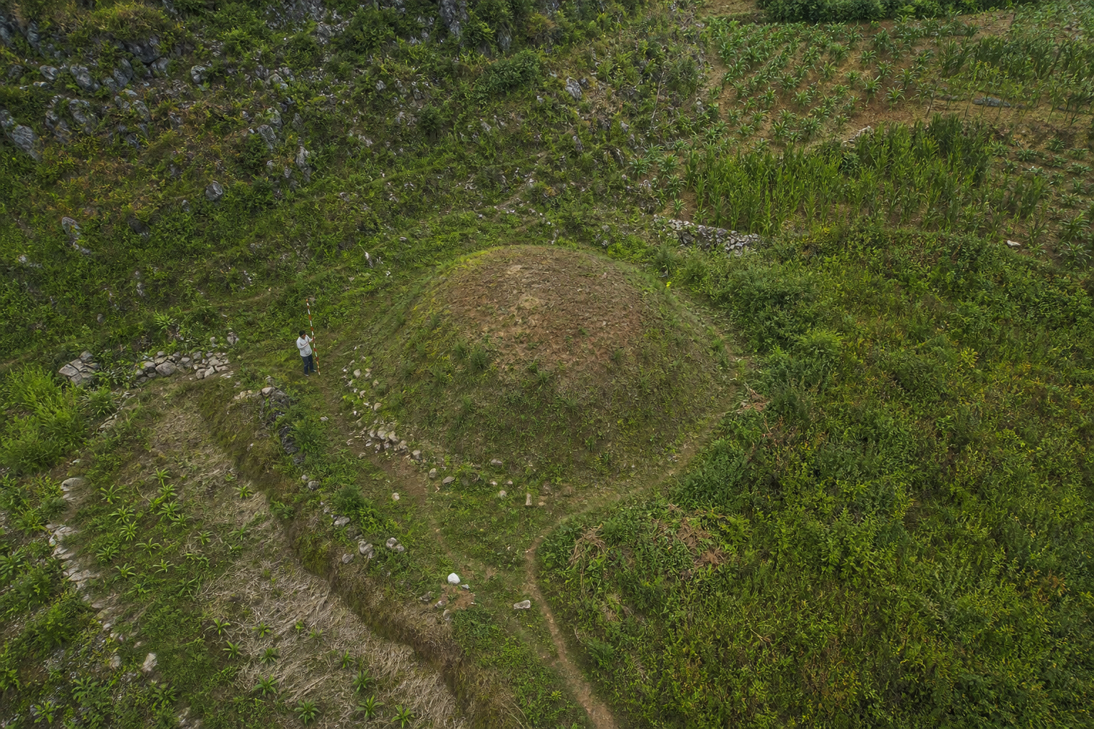
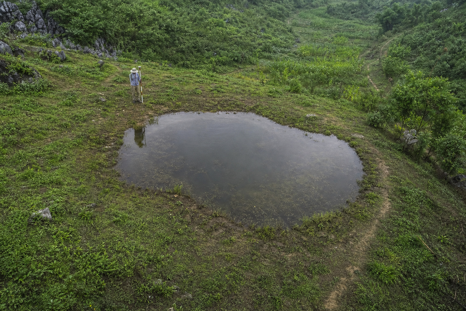
Separate mound and astro-pond studies
These are generated raster reconstruction images, not satellite captures. They visualize two separate feature types at the observed scale: low earth pimples or shrine/mound features around 8-10 m across, and small covered or organic-looking water apertures often around 15 m across. The generated images keep those features separate; the short offset relationships belong to the maps and close imagery, not to a same-footprint before/after overlay.
Generated ground-level rendering
MSS containment hub from the service road
This generated rendering translates the completed grassed compound through shadow, window, roof, and disturbance inference: the main block reads as a taller L-shaped form, with the black-roofed short leg pushed to the highest roofline and standing 1-2 stories above the surrounding service wings and perimeter walls. Repeated window/opening bands and shadow massing support a working height range around 30-40 ft. The uphill cut now reads as reclaimed terrain: seeded green cover and young, thinner tree growth distinguish the disturbed slope from the denser surrounding forest, while stabilized grassed pads, green berms, pale service-road edges, and switchback roads preserve the latest aerial's completed-form terrain. It is a visual hypothesis constrained by overhead imagery, not a ground photograph.
Suppression architecture indicators
The Wushan-Daning baseline describes a walled surface compound, a candidate 20 m x 10 m vertical shaft, a predicted 600-900 m karst cathedral chamber with an underground river, south-face linear features that fit dosing or transmission staging, and an offset pad that fits secondary emission, vent, or egress use. Those are not the signatures of a symbolic pond. They are the signatures of an engineered terrain interface.
The important nuance is that suppression depends on preserving the substrate. Destructive extraction would break the channel. Passive monitoring would only listen. The archive's "weaponized custodianship" reading is the middle condition: maintain the biological function of the channel in order to use that function adversarially.
What would change the reading
The archive reading remains falsifiable. Higher-resolution imagery could resolve the south-face linear features and the offset pad. Pre-2018 imagery could test whether the visible compound was greenfield or older infrastructure. Downstream water chemistry and low-frequency EM measurement would separate the suppression-installation reading from ordinary forestry, military, hydrology, or monitoring alternatives.
Until then, the claim should remain precise: Shizhu Astro-Ponds are being investigated as terrain-bound suppression apertures in the Wuling/Shizhu archive model. Communication is not erased, but it is subordinate to containment.