Sbd relevance
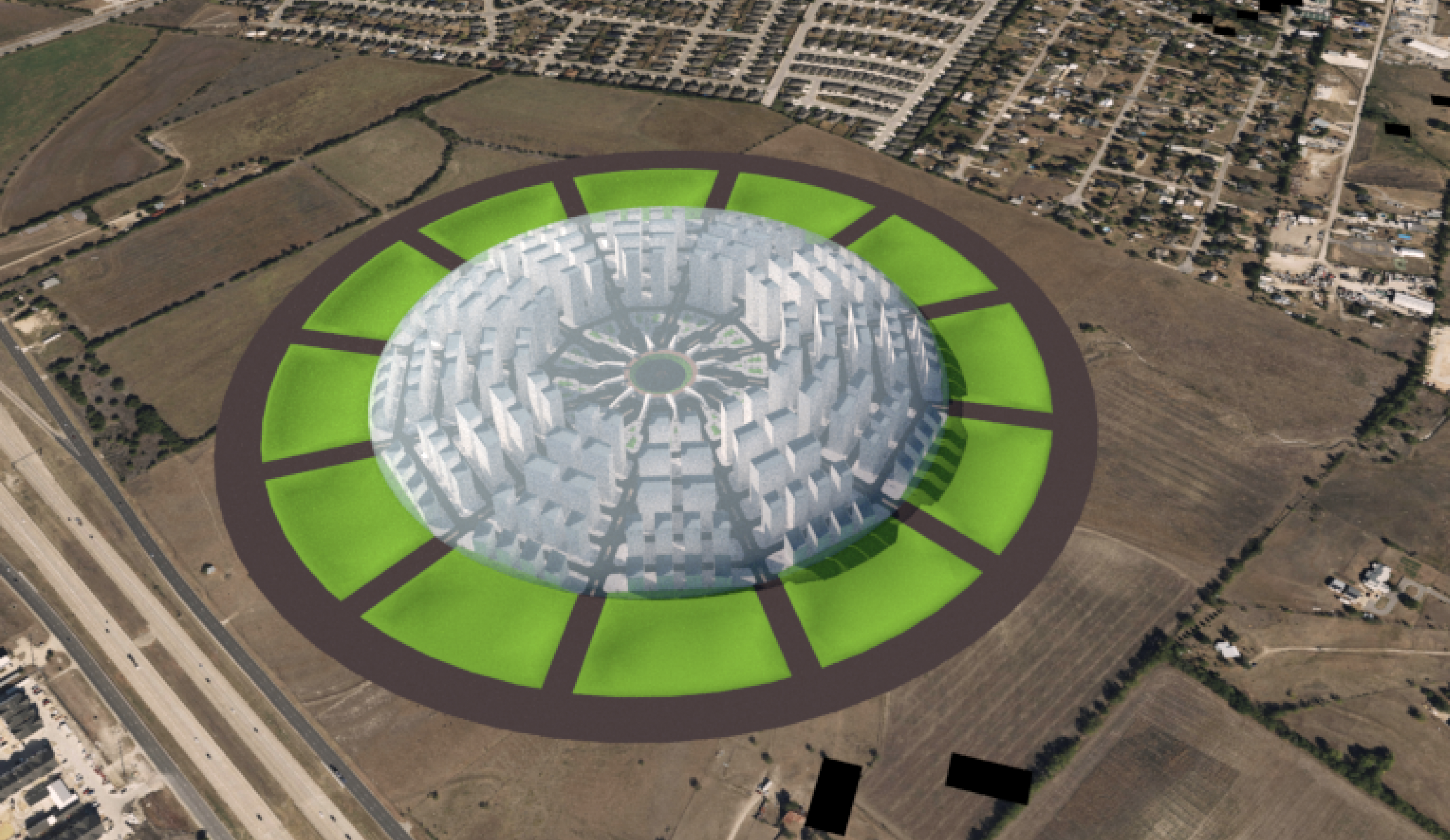
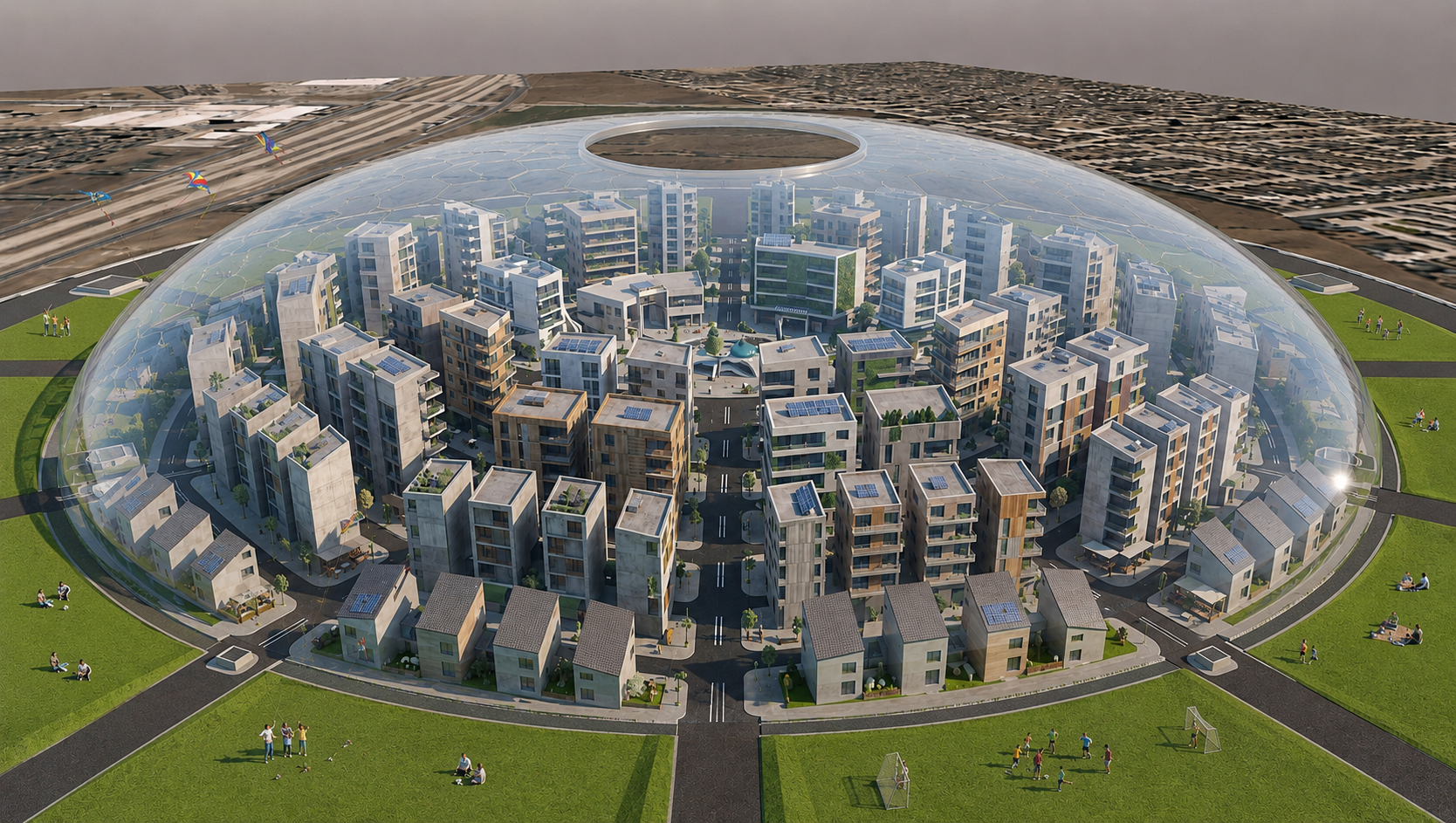
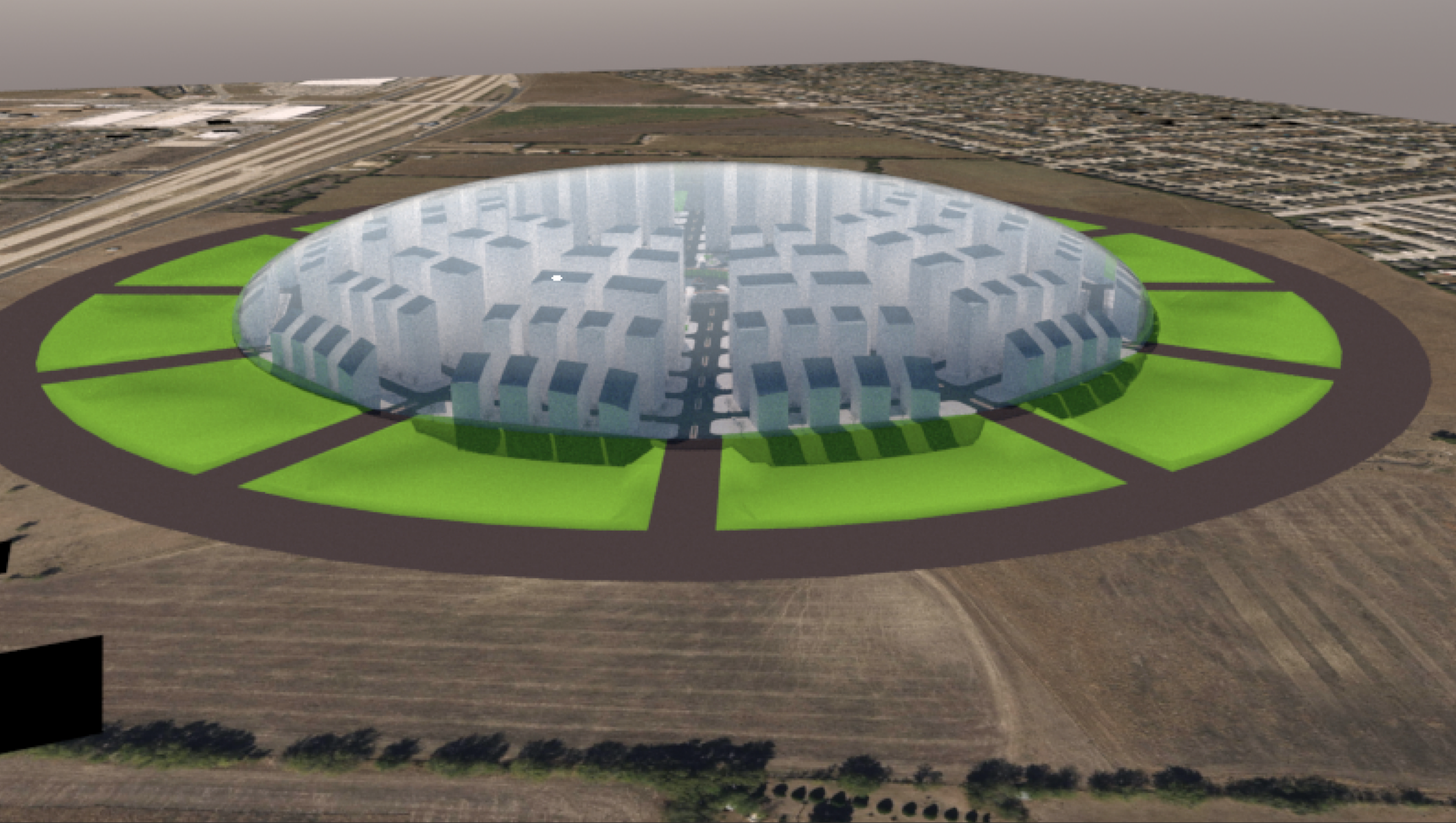
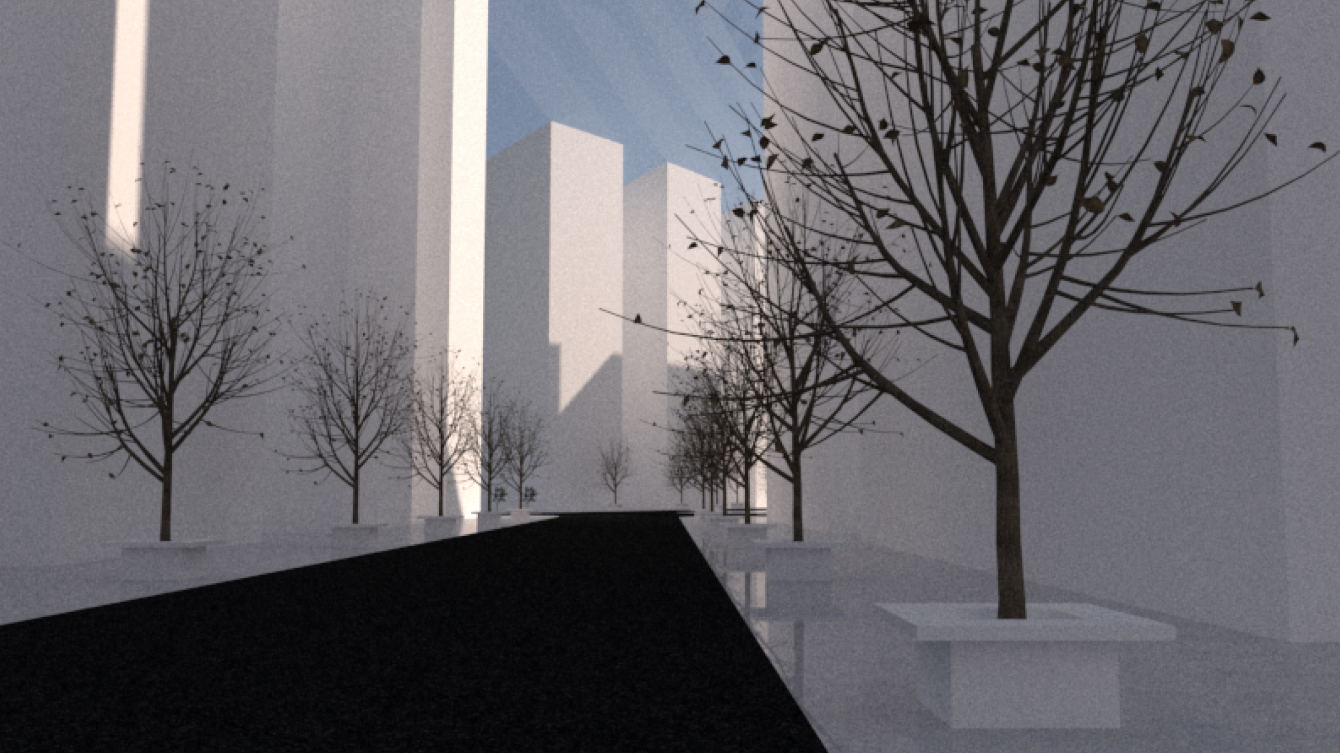
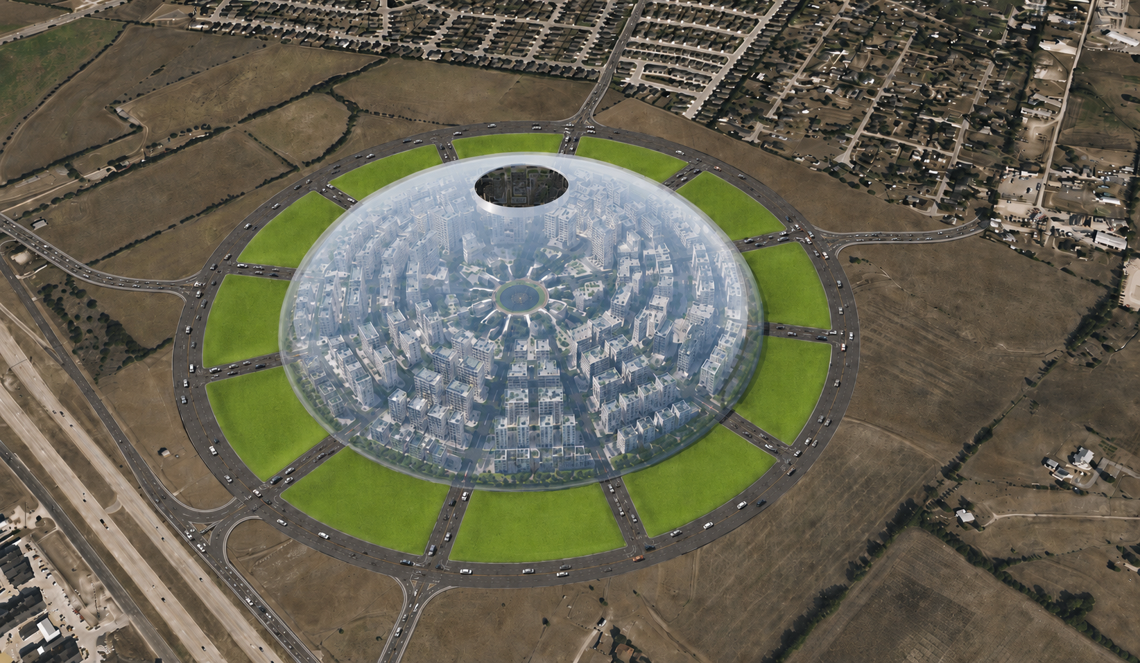
The urban sphere plates make the district-scale ambition of sphere-based design visible. instead of beginning with a block grid, the concept starts with a spherical envelope, then cuts public space, circulation, and landscape into radial sectors that can be read from both aerial and street-level views.
Urban form lesson
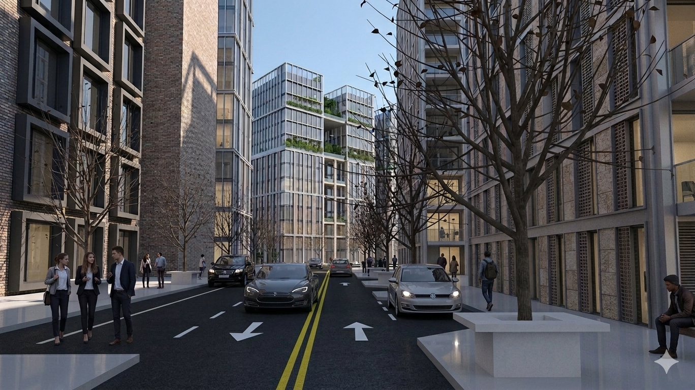
The value of the study is the contrast between exterior legibility and interior experience. exterior legibility gives the district a clear organizing field — geometric footprint, radial landscape wedges, translucent environmental shell — that reads from above. interior experience breaks that field down into human scale: street canyons and civic corridors, tower spacing and tree rows, dynamic shadow play. the sphere has to work at both registers simultaneously.
Five-layer radial section
The concept cuts public space, circulation, and landscape into five stacked layers rather than a flat block grid. layer 1: perimeter circulation ring — the outer road that keeps through-traffic at the edge. layer 2: radial green wedges — park sectors that read from aerial and street views alike. layer 3: arterial access points — the radial spokes that connect the perimeter road to the center. layer 4: interior street canyons — the human-scale corridors between buildings inside the shell. layer 5: central smoke and vent aperture — the open top that handles stack ventilation, smoke exhaust, and daylight to the center. each layer does a different kind of work; the section is legible because the layers do not overlap.
Design lineage
The urban sphere sits between two related bodies of work. radial wave tessellation came first: raw geometric patterns and base layout logic, working out how radial subdivision behaves as a planning field. the urban sphere is the middle step — moving that geometric pattern into an inhabitable district prototype with a shared environmental envelope and a real mixed-use program. rwt tower town la is the applied step: taking the internal street networks and radial subdivision into localized planning studies at actual candidate sites in los angeles. the three phases move from pattern to prototype to place.
Civil plausibility
The updated main render is plausible as a concept image because it shows a clear perimeter road, multiple radial access points, exterior park wedges, an internal street network, and an open central aperture that can be studied for smoke exhaust, stack ventilation, maintenance access, or daylight. it should not be read as an engineered dome yet. the next feasibility questions are shell span and support, seismic movement, fire and smoke control, emergency vehicle reach, utility corridors, stormwater, heat gain, glare, cleaning, replacement panels, and whether the dome is a true structural enclosure or a lighter environmental canopy over independently code-compliant buildings.
Mixed-use economy
The urban sphere should be understood as a restaurant-and-services district with housing above, not a housing project with leftover retail at grade. ground floors carry restaurants, cafes, bakeries, bars, small grocers, boutiques, salons, clinics, daycare, repair, fitness, galleries, and daily services. lower and mid-level floors can flex between professional offices, coworking, studios, live-work units, and residences, while upper floors carry most of the housing.
Vertical zoning
The section divides into three named tiers. ground level is the daily economy: a dense restaurant-and-services district designed for cafes, bakeries, small grocers, clinics, daycare, fitness, and daily services — not leftover retail. mid-levels are flex space: professional offices, coworking spaces, studios, and live-work units that can shift with demand. upper floors are primary residential housing. the stacking matters because the ground tier is not a service to the housing above — it is the economic engine that makes the housing viable. residents create demand; the ground economy fulfills it and builds a supply chain the whole district can draw from.
Small-kitchen housing model
Many residential units can use compact everyday kitchens rather than full suburban kitchens. the sphere compact model is equipped with essentials: a sink, induction hob, small fridge, and basic reheating space. the suburban kitchen model it replaces carries a huge double-door refrigerator, large bulk storage pantry, multiple prep zones, oversized appliances, and oversized counters. the compact model does not remove food choice — it intentionally shifts storage and prep capacity out of the private apartment and into shared neighborhood infrastructure. the result is a district where restaurants, markets, grocers, shared kitchens, and prepared-food vendors become part of daily life rather than a supplement to private cooking.
Neighborhood pantry
The food economy operates as a three-node flywheel. node 1: residents with compact kitchens create steady, daily demand for prepared meals and small fresh purchases because less private storage is available. node 2: local restaurants and cafes fulfill that demand and buy directly from local grocers, bakers, butchers, and specialty importers — building a high-quality supply chain inside the district. node 3: local grocers and commissaries supply the restaurants and sell from that same supply chain directly to residents. the flywheel is self-reinforcing: compact kitchens drive restaurant demand, restaurant demand builds the supply chain, and the supply chain serves everyone in the district. the result is access to vastly better ingredients and variety than a standard residential grid could support.
Population and jobs
As a planning assumption, the prototype can be tested around 12,000 to 18,000 residents, with 15,000 as a useful midpoint. retaining 30 percent local work creates a true daytime neighborhood: at 15,000 residents, a 70/30 split produces roughly 10,500 outbound commuters leaving the district and 4,500 internally supported workers — captured via work-from-home, employment inside the sphere, or jobs in the local service and professional economy. the 30 percent threshold is not a fixed target; it is the level at which the district generates enough foot traffic during the day to sustain the restaurant, cafe, and services economy that makes the sphere work. below that threshold the ground-floor economy struggles; above it the district becomes a genuine 24-hour neighborhood rather than a bedroom suburb under a dome.
Hidden logistics
The public streetscape — visible streets with many small, outward-facing storefronts — depends on infrastructure that runs below it and behind it. design implications: dedicated zones for frequent daily deliveries so trucks do not block the street canyons. shared prep kitchens and cold storage nodes that serve multiple restaurants and reduce private storage footprints. integrated waste and compost loops so the food economy does not generate visible refuse on the public realm. clear thresholds between public activity and private spaces so the street reads as active without exposing the logistics layer. the sphere replaces the inward-facing mall model with a street-facing district, which means the logistics layer has to be as carefully designed as the public face.
Design implications
The sphere works when density funds local culture, and local culture makes density livable. compact housing modules drive the economic capture required to build a vibrant street-level ecosystem, transforming a geometric prototype into a self-sustaining neighborhood. the district needs many small storefronts, not one inward-facing mall; visible streets that reward pedestrian circulation; a logistics layer (deliveries, cold storage, waste loops) hidden below the public realm; and clear public/private thresholds. get those elements right and the flywheel runs on its own.