Premise — and audit correction
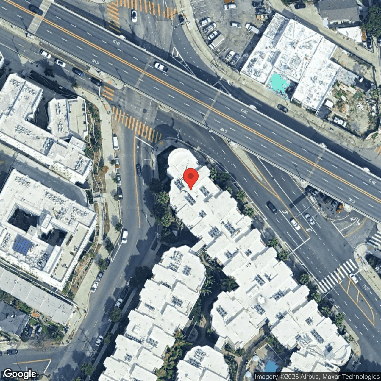
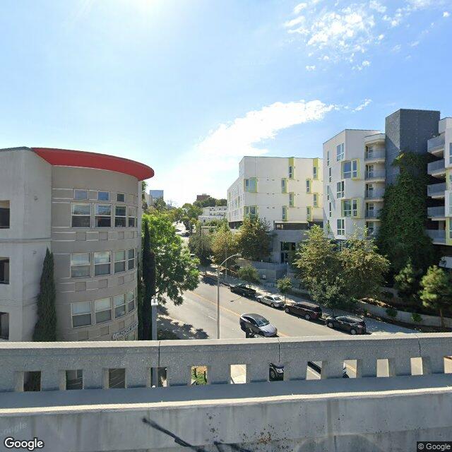
The Belmont Tunnel was the western portal of the Pacific Electric subway that carried Red Car interurban rail from downtown to the Westside, 1925-1955. The tunnel was sealed in the 1950s after the rail line was discontinued and remains underground; what survives above ground is the western portal opening (a sealed concrete archway) and the Toluca Substation building (the small domed structure at the north edge of the parcel). Between the 1950s and roughly 2007, the surface rail yard above the sealed tunnel sat vacant — used informally as a graffiti site, a film location, and a homeless encampment until perimeter fencing was installed. The structures were designated historic-cultural monument in 2005, principally to protect the portal opening + the substation as artifacts of LA's pre-freeway transit history. Circa 2008-2010 the surface land was redeveloped as the Belmont Station Apartments — a 5-story mixed-use residential block built on top of the sealed tunnel, with the portal opening retained at the east edge of the parcel (where the tunnel mouths) and the substation retained at the north edge. The audit classified this as a blocking-redevelopment candidate based on older signals (long-vacancy data from the pre-2008 period and a manual vacancy override that was never refreshed). That classification is stale. The surface land is built out; the portal opening and substation are preserved at the parcel edges; the tunnel itself remains a sealed underground feature beneath the apartments. This case study has been re-framed (2026-05-14) from a delisting candidate to a successful preservation-with-redevelopment integration.
Rubric scores
A. Would-survive: 2/10 — vacant, no income, no preservation subsidy. B. tourist currency: 0/10 — 415 Wikipedia pageviews, no walking tours, no destination visitation. C. subsidy efficiency: 0/10 — no Mills Act, no federal HTC. D. externality load: 6/10 — 8 code complaints, perimeter fencing, recurring graffiti load on adjacent parcels. E. neighborhood health: 3/10 — tract median household income $32,000. F. alternative-use value: 9/10 — 1-acre parcel within 1/4 mile of Westlake/MacArthur Park b-line and d-line stations, high zoning capacity, scarce buildable land in a tract that desperately needs both housing supply and family-supporting density.
What actually happened (the redevelopment story)
Between 2007 and 2010, a private developer entitled and built the Belmont Station Apartments on the surface land above the sealed tunnel — a 5-story mixed-use residential project of roughly 280 units sitting on top of the former rail yard. As a condition of the entitlement, the HCM-designated portal opening and the Toluca Substation building were preserved in place. The portal opening remains as a sealed concrete archway at the eastern edge of the parcel where the tunnel mouths underground; the substation sits at the northern edge against the freeway off-ramp. The apartments occupy the surface area between these two preserved features. The project demonstrated that the "freeze the entire parcel" reading of HCM status was not necessary — the designation could be honored by preserving the specific above-ground structures while permitting the surface land above the (already-non-functional) underground tunnel to be redeveloped at transit-priority density. This is the same procedural template as the Sears mail-order district (partial demolition with selective retention) but applied to infrastructure where the most-significant element is the underground void itself, and where the relevant above-ground artifacts can be preserved as edge features of the new development.
Why the original audit verdict was wrong
The HCM-1200 audit classified HCM-790 as blocking-redevelopment via a manual vacancy_status override set on early data. The override was applied when the parcel was effectively vacant (pre-2008, pre-redevelopment). The rescore pipeline preserves manual overrides — vacancy_status_inferred=false — so subsequent rescores kept the stale flag even after the apartments were occupied. This is a real audit failure: a manual override outlived the conditions it documented. There are likely other parcels in the 1295-HCM list with the same pattern — single-snapshot vacancy data that has since been resolved by redevelopment. Surfacing these requires a periodic refresh of vacancy_status against current LADBS permits + assessor records, not just trusting the prior override.
What this case is actually evidence for
HCM-790 is not a delisting candidate. It is evidence that HCM designation + transit-priority entitlement + community-benefits negotiation can deliver preservation and density together. The cultural significance was honored (portal + substation preserved). The parcel was redeveloped at substantial scale. Residents now live on the parcel and walk to two Metro rail stations. This is the procedural template the HCM-587 area study and the cadet records area study are reaching toward — and one local government has already demonstrated it works.
What the recommendation is (revised)
Remove HCM-790 from the audit's delisting / blocking-redevelopment cohort. Retain the HCM designation as currently scoped (portal + substation are correctly preserved). Use the case as a procedural precedent in the HCM-587 + cadet records area-study packets — "this is what preservation-with-redevelopment looks like when it lands well, including the integration of a historic portal into a publicly accessible apartment courtyard." for the audit data: build a "stale overrides" check that flags any HCM with vacancy_status_inferred=false where the override is older than 18 months and where new LADBS permit activity has appeared in the radius since.
Linked work
See /HCM-1200/HCM-790 for the per-HCM detail page with radar chart, fetched data table, and polygon footprint. See /sphere-based-design/HCM-1200 for the audit overview and explorer. The parcel sits within walking distance of the Vermont-Athens RWT tower-town candidate site geometry as a smaller-scale variant.
Design proposals (retained as methodology — see header note)
The design proposals below were drafted before the audit recognized the parcel had already been redeveloped. They describe alternative rectilinear and sphere-based redevelopments of a parcel that no longer needed to be designed because the apartment build-out happened in 2008. They remain useful as a methodology comparison — what the audit's rectilinear vs sphere-based design rule would have produced if the parcel had been raw at the time of consideration — but they are not active recommendations.
Design proposal — rectilinear form (retrospective)
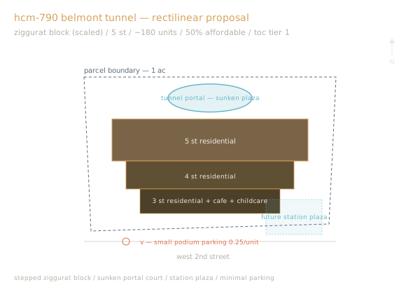
A stepped ziggurat block (5 / 4 / 3 stories), ~180 units, 50 percent affordable under TOC tier 1 density bonus. The tunnel portal becomes a sunken courtyard accessible from a small interior plaza, with the masonry portal frame restored as the feature wall. Ground floor: corner cafe, childcare, bike repair, all facing the future Belmont Station plaza on West 2nd Street. Parking 0.25 spaces per unit — the parcel is within a quarter mile of two Metro rail lines, so a deeper transit-only program is justified. The form treats the portal as a basement curiosity, accessible but not central. Retrospective only — the actual Belmont Station Apartments project (~280 units, 5 stories, ~2008) overshoots this proposal's density.
Design proposal — sphere-based form (retrospective)
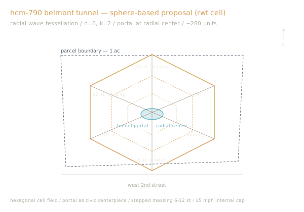
A small radial wave tessellation cell — n=6 hexagonal field, k=2 subdivision depth, with the tunnel portal as the literal radial center of the cell. Five housing wedges, one amenity wedge (library, daycare, gym). Stepped massing rises from 6 stories at the portal to 12 stories at the cell perimeter, producing continuous edge density without a flat-faced wall toward the surrounding low-rise context. ~280 units. The portal masonry is restored as the central plaza feature, with light wells cut through the wedge cores to expose the original tunnel mouth back to the sky. 15 mph internal cap. The RWT geometry treats the portal as a piece of urban infrastructure that organizes the parcel rather than a basement object that the parcel tolerates. Retrospective only.
Comparison (retrospective)
The rectilinear block is cheap, fast, and clean — it follows the TOC-tier playbook and treats the portal as an artifact to retain but not necessarily to celebrate. The RWT cell is more ambitious. It tests whether the radial form can make a piece of dead transit infrastructure into a civic centerpiece, and whether the parcel can carry 100 more units than the stepped block by distributing mass radially instead of orthogonally. The RWT cell is a smaller-scale variant of the Vermont Athens tower-town site (case b+d crossing condition), so the same form rules apply.